Search This Blog

Sunday, November 19, 2023

Cinema📽️Top Dance 💃🕺 Scenes

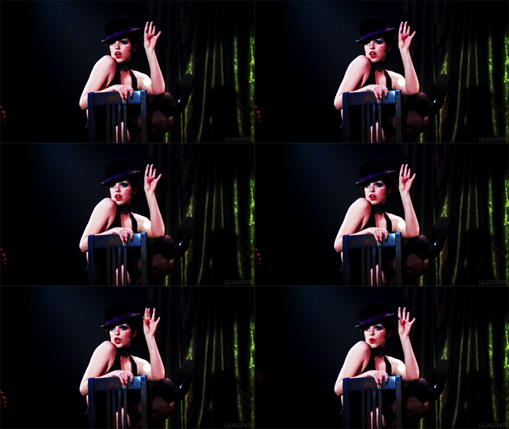
💃 Top 10 Movie Dance Scenes 🕺 
 https://66.media.tumblr.com/16d2db8a70f6c11d9288c31119abc840/tumblr_piyuluOvon1urtgw2o4_r1_540.gifv
Of All Time
Not every movie is a musical, or holds an all-out dance number, but some of the most awe-inspiring, touching, and downright beautiful moments in film history have been set to music and brought to life through dance. 
These are some Favorites.

THE LIST
💃
Chicago (2002)
The Cell Block Tango is a Broadway stage number magically brought to life on screen.
Choreographer: Rob Marshall
🕺
Shall We Dance (2004)
Choreographer: Joann Jansen & Liz Curtis
Richard Gere and Jennifer Lopez’s tango in the night is one of the best-shot ballroom numbers committed to film.
💃
Dirty Dancing (1987)
Choreographer: Kenny Ortega
I mean, who DOEN’T love that lift in the finale??
💃
Gold Diggers of 1935 (1935)
Choreographer: Bubsy Berkeley
The Words Are in My Heart number in Gold Diggers is the best of Berkeley’s extremely distinguished career.
🕺
Magic Mike (2012)
Choreographers: Allison Faulk and Teresa Espinosa
Okay, what it lacks in formality, it makes up for in fun. And sexiness. And some major, honest-to-goodness dance skills.
💃
Dil Se (1998)
Choreographer: Farah Khan
The train top number from Dil Se was ACTUALLY on top of a moving train.
💃
Pina (2011)
Choreographer: Pina Bauch
The Vollmund number in this documentary about the life and work of the legendary choreographer is a stunning insight into her life and her artistry.
🕺
Step Up 2: The Streets (2008)
Choreography: Dave Scott, Hi-Hat, Jamal Sims
There wouldn’t be the Step Up franchise without the second movie proving it could be done again (and again, and again). And the finale dance in the rain earned the franchise every movie that’s come since.
🕺
Singin’ in The Rain (1952)
Choreography: Gene Kelly
Often imitated, never replicated, possibly the most iconic dance scene in all of cinema. Nuff Said.
💃
Stormy Weather (1943)
Choreography: Nick Castle
The Nicholas Brothers take our top spot with their Jumpin’ Jive performance, which Fred Astaire claimed was the greatest movie musical he’d ever seen. We agree.
What did you think of the list?
Did we leave off one of your favorite numbers? 
https://66.media.tumblr.com/fac9b7a6685cff31f519e8cb984fdab2/tumblr_ppclhhOeXw1urtgw2o4_500.gifv
https://66.media.tumblr.com/81d2afe14225bad6892b6d165ecb7c48/tumblr_piofi2VVYZ1urtgw2o2_500.gifv
Did you agree with our picks? 
What’s your favorite movie dance scene? 
Did you like any of our honorable mentions more than our actual picks? 
What other aspects of movie magic would you like to see us explore in a future list?
Subscribe: http://goo.gl/9AGRm
https://66.media.tumblr.com/0e0d493a48fc5c5dc39e0d416c1df84f/tumblr_ppclhhOeXw1urtgw2o3_500.gifv

Friday, November 17, 2023

Garden🌱Plants🥀Time-Lapse✔️

🥀  Garden 🌱 Plants 🌹
🌼  Time-Lapse  🌻
 Image from Nature
     👇   📺   👇                          Click  Below  to   Choose   a Video   

Garden 🌱 Plants 🥀 TimeLapse 🌷
LargerVideos

#Tulips from Nature#Tulips from Nature#Tulips from Nature #Tulips from Nature

Wednesday, November 15, 2023

NYC 🗽Vintage 📽️

NYC  🗽 Vintage  📽️  Videos
https://64.media.tumblr.com/bc9d706972edd6f33dda588d5bcabca5/6f93f936db0d54bd-6c/s1280x1920/7934a33e40a04128bd00f14969ad77fd18bb0b32.jpg
One Times Square, the famous building on the south end of Manhattan's Times Square built, was once the home of The New York Times. It was completed in 1904 and the Times stayed there for just 10 years before moving out. Over the next century, the building would become a home to a speakeasy, a shooting range, and offices. But ever since the massive billboards went up, the building has remained empty. 
In this vintage photo from 1908, see the building in its original state, before 90% of it was plastered with advertisements. Here is a Google Street View of how the same angle looks today.
                                         👉   Wait for Next Video to LOAD  👀 or  Click  Below  to Choose   a Video   👇
#
NYC  🗽  Vintage 🍎 Videos 📽 Time
1 New York 1911 (New Version) in Color [60fps Remastered] w/added sound 6:35
2 Amazing New York in 1910 in color! [A.I. enhanced & colorized] 9:44
3 Surreal Old Timey Film Of New York City In 1911 7:14
4 1890s New York 3:39
5 The New York City Evolution Animation 8:58
6 Elevated Railroad, New York City, 1903 1:11
7 What Happened On 23rd Street, New York City 1:20
8 Old Penn Station New York City with aerial & skyline views   3:34
9 Old Penn Station 2:47
10 Walt Whitman "Mannahatta" Poem animation 2:37
11 100 Years Evolution of traffic - 1910s till the 2010s 5:15
12 New York: A Journey Through Time 10:54
13 Times Square Over Time 1:19
14 A Trip Through New York City in 1911 [4k, 60 fps]  8:36
15 New York in the mid 1930's in Color! 41:54:00
16 What's left of New Amsterdam in Lower Manhattan - 2/4 6:18
17 Manhattan: What Henry Hudson Saw in 1609 | National Geographic 1:39
18 NYC Water Supply Animated History 2:35
19 Marilyn Monroe's White Dress Moment | 1901 Film Version [ 60 fps] 1:07
20 These Men Risked Their Lives to Build 1920s New York Skyscrapers 2:15
21 New York 1945 in color [60fps, Remastered] w/added sound 4:57
22 Bethesda Terrace Central Park - Then and Now 8:29
23 New York’s LOST Skyscraper - The Rise and Fall of SINGER TOWER  19:43
24 New York in the early 1900s in color! [A.I. enhanced & colorized] 12:09
25 America in Color 1920s 0:25

https://64.media.tumblr.com/ac5c85fc9225bc82868cb1b3532fb2ce/eaba3b96103f0e5e-c0/s1280x1920/994055d6c12d07633f9d399488452c9fd06e7b9b.jpg
Old film of New York City in the year 1911. Print has survived in mint condition. Slowed down footage to a natural rate and added in sound for ambiance. This film was taken by the Swedish company Svenska Biografteatern on a trip to America
 -  1 yr before Titanic.
 -  3 yrs before WWI.
 -  9 yrs before women could vote.
 - 18 yrs before stock market crash.
👇   📺   👇
https://64.media.tumblr.com/bc9d706972edd6f33dda588d5bcabca5/6f93f936db0d54bd-6c/s1280x1920/7934a33e40a04128bd00f14969ad77fd18bb0b32.jpg
  🗽  NYC  🍎 🗽  🍏 📽

Tuesday, November 14, 2023

La Traviata🎼 "Noi Siamo Zingarelle"

🌷🌷 La Traviata 🌷🌷
Coro di Zingarelle e Mattadori
 

https://youtu.be/Ixbrot9hq5U
La Traviata
"Noi Siamo Zingarelle"
Chœur des Bohémiennes

La Traviata de Giuseppe Verdi
Opéra Bastille 🎼 Mise en scène de Benoît Jacquot
Direction musicale de Giacomo Sagripanti / Karel Mark Chichon
https://www.youtube.com/c/operadeparis
https://youtu.be/ksRiOHOzG7Q

🌷🌷🌷🌷
'Coro di Mattadori Spagnuoli'
'Chorus of Spanish Matadors'
Glyndebourne
The cast of the 2014 production of La Traviata Nov 14, 2017
😮 What the heck is this ?? 😯

https://youtu.be/bDRq7Mszy08
🌷🌷🌷🌷
 Noi Siamo Zingarelle - Soprano
Noi Siamo Zingarelle 
Rehearsal Track for Soprano voice
From Opera La Traviata by Giuseppe Verdi
🌷🌷🌷🌷

Sunday, November 12, 2023

Diwali 🪔Practices🌟Traditions

Diwali
Hindu Festival of Lights
The celebrations for this auspicious Hindu festival
What is Diwali?
Vedic scriptures mention the festival as Padma Purana, celebrated after the harvest season according to the Hindu calendar.
Usually Observed for Five Days.
  1. The 1st  day of Diwali celebrations is called Dhanteras. In India, it is believed that buying jewelry (gold or silver) on this day is auspicious.
  2. The 2nd  day of Diwali is called Narak Chaturdasi, the 14th lunar day. Homes light 14 diyas to ward off evil.
  3. The 3rd day is when Diwali is actually celebrated with family and 21 diyas are lit.
  4. The 4th day, people celebrate Govardhan pooja, in remembrance of Lord Krishna who, in mythic tales, lifted Govardhan Hill to shelter the people in Vrindavan from heavy rain.
  5. The 5th day celebration ends with observing Bhai Dooj
During Diwali
Homes are Cleaned to Welcome
The Goddess of Wealth
Laksmi Into their Homes
Candles and lamps are lit as a greeting to Laksmi

The Indian New Year
Celebrated at the End of Diwali
On this Day Everyone Wears Something New to Signify Abundance in their Lives
🙏🕯 🙏🏽 🕯🙏🏿 🕯 🙏🏼
🪔  🇮🇳   🥻  🍛  🔥 🪔   🇮🇳  🥻
  • House cleaning
  • Shopping - People wear new clothes on each day of celebration
  • Diwali Sweets  - Chakli, Peda, Barfi, and Laddoo  Almost all sweets are made with broken pieces of dry fruits.
  • Rangoli - People decorate their home with Rangoli, a colorful artwork made with rice powder.
  • Exchanging Gifts and playing cards - Close and extended families pay visits at one another’s place for hours of banter, card playing, and gifts!
Diwali / Deepavali Observances Dates
2024    Thu    Oct 31     Diwali/Deepavali
2025    Mon    Oct 20   Diwali/Deepavali
2026    Sun    Nov 8     Diwali/Deepavali
2027    Thu    Oct 28    Diwali/Deepavali
2028    Tue    Oct 17     Diwali/Deepavali
2029    Mon    Nov 5    Diwali/Deepavali
2030    Fri    Oct 25      Diwali/Deepavali

🙏🕯 🙏🏽 🕯🙏🏿 🕯 🙏🏼
🪔  🇮🇳 🌟   🥻  🍛 🔥  🇮🇳 🌟 🥻 🪔

Friday, November 10, 2023

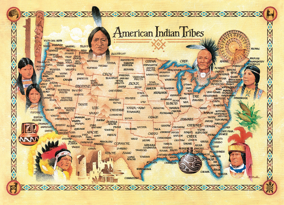
Native Americans 😞Lost Billions of Acres to U.S.

How the U.S.
Took More Than 1.5 Billion Acres
From Native Americans

See Interactive Time-Lapse Map + VIDEO Below
By Rebecca Onion and Claudio Saunt
👇https://66.media.tumblr.com/ba5fe908ae307eceb4e5ff9b080796e0/tumblr_ptmt8qUXrP1vprwrro2_r1_1280.gif 👇
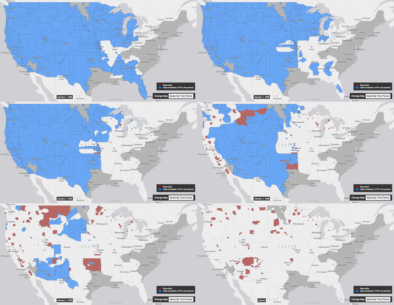
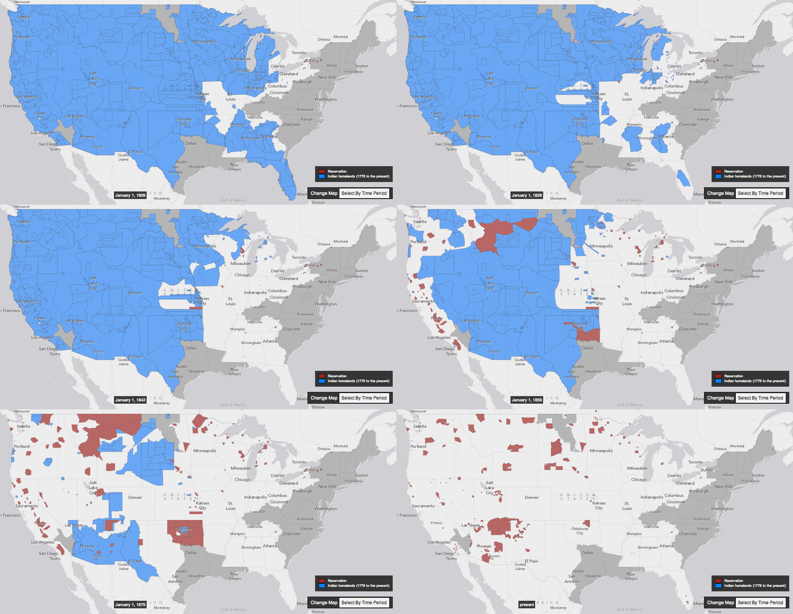
This interactive map, produced by University of Georgia historian Claudio Saunt to accompany his new book West of the Revolution: An Uncommon History of 1776, offers a time-lapse vision of the transfer of Indian land between 1776 and 1887. As blue “Indian homelands” disappear, small red areas appear, indicating the establishment of reservations.  (Above is a GIF of the map's time-lapse display; visit the map's page to play with its features.)
*
The project’s source data is a set of maps produced in 1899 by the Bureau of American Ethnology. The B.A.E. was a research unit of the Smithsonian that published and collected anthropological, archaeological, and linguistic research on the culture of North American Indians, as the nineteenth century drew to a close.
*
While the time-lapse function is the most visually impressive aspect of this interactive, the “source map” option (available on the map's site) offers a deep level of detail. By selecting a source map, and then zooming in to the state you’ve selected, you can see details of the map used to generate that section of the interactive. A pop-up box tells you which Native nation was resident on the land, and the date of the treaty or executive order that transferred the area to the government, as well as offering external links to descriptions of the treaty and of the tract of land.
*
In the site’s “About” section (reachable by clicking on the question mark), Saunt is careful to point out that the westward-moving boundaries could sometimes be vague. Asked for an example, he pointed me to the 1791 treaty with the Cherokee that ceded the land where present-day Knoxville, Tenn. stands. The treaty's language pointed to landmarks like "the mouth of Duck river," a broad approach that left a lot of room for creative implementation. When dealing with semi-nomadic tribes, Saunt added, negotiators sometimes designated a small reservation, "rather than spelling out the boundaries of the cession."
*
This vagueness benefited the government’s purposes in crafting treaties and executive orders. “Greater legality and more precision,” Saunt argues, “would have made it impossible to seize so much land in so short a time.”
https://64.media.tumblr.com/38acc2130bdb359f8f48a94c739afa97/48338a81d16e2aea-5a/s1280x1920/78ff1b64bc791d35a453b7d6d98c0a2111964b6b.jpg
#Native Americans from PoPolitiko
The Invasion of America
Spotted Fins Fishing
This doesn't show reservations that are southeast. Such as Eastern Band of Cherokee or Poarch Band of Creek. Which are both federally recognized
*
eHistory.org
The map only shows all Indian reservations over 640 acres.  
For a detailed view, please see our interactive site at invasionofamerica.ehistory.org.
*
https://66.media.tumblr.com/ba5fe908ae307eceb4e5ff9b080796e0/tumblr_ptmt8qUXrP1vprwrro3_r1_1280.gif
Invasion of America
How the United States Took Over an Eighth of the World
Between 1776 and 1887, the United States seized over 1.5 billion acres from America's indigenous people by treaty and executive order. The Invasion of America shows how by mapping every treaty and executive order during that period. It also contains present-day federal Indian reservations.
*
The data are based on the maps produced by the Bureau of American Ethnology in 1899 under the guidance of Charles C. Royce. The maps themselves are available under "Source Maps."
*
In treaty discussions, US troops often intimidated the negotiators, federal agents misrepresented the terms of agreement, and land speculators bribed participants. In desperate times, Indians signed away their homes in order to feed themselves and their families. In the 1850s, US presidents began using a second legal instrument to secure land, the executive order, and this prerogative grew in importance after 1871, when the federal government unilaterally stopped making treaties with native peoples. The power of the president to seize land by executive order may appear contrary to the sanctity of private property, one of the great legacies of the American Revolution, but white Americans never set Indian land title on the same footing as their own. Nor did they recognize the irony of their presumptions.
*
In treaties and executive orders, the borders of each transaction are often spelled out in general terms only, making it impossible to map with any precision. That imprecision, which seems so foreign in the era of Google maps, was integral to the process of seizing the continent. Government surveyors were sent out with the vaguest of descriptions. They searched fruitlessly for headwaters, guessed which river fork they were supposed to ascend, and speculated where drainage basins began and ended. Greater legality and more precision would have made it impossible to seize so much land in so short a time.
🏹🦬🦅🪶
🏹  ~*~🦬*~~*~*~~*~*~~*~🪶~*~*~*~~*~🦅*~~*~*~🏹   
CREDITS
The Invasion of America is a project of eHistory.org.
Project director: Claudio Saunt, Russell Professor of History at the University of Georgia
Technical director: Sergio Bernardes, Center for Geospatial Research
Special thanks to David Holcomb and Daniel Reeves at ITOS for implementing the map on ArcGIS Server.
*
* In the first scene, 1492, the first spanish colony wasn't in modern cuba, it was Hispañola.
*
#Native Americans from PoPolitiko
https://64.media.tumblr.com/abf6e58d1757475a7a7c1c141b9ff3eb/48338a81d16e2aea-ff/s1280x1920/9862921febcd766baee86a5f6aab9d65c571f787.jpg

Thursday, November 9, 2023

Earth 🚀Time-Lapse

🌎 Time-Lapse 🚀🌍Earth🌏
https://64.media.tumblr.com/8ebfebca940d5d5d156f2dacfdfbe139/b86aca1bf067899a-00/s1280x1920/b9686da37f693337fdf37209222851a144cbfe1f.pnj
Timelapse From Space Will Leave You Humbled

Man (or woman) can only dream what it looks like hovering above earth watching the beauty of science orbit beneath them. Thanks to the ISS (International Space Station) we have the next best thing, a time-lapse. 
“Some interesting tidbits about the ISS. It orbits the planet about once every 90 mins and is about 350 Km/217 miles. The yellow/greenish line that you see over the earth is Airgolw. All footage has been color graded, de-noised, deflickered, slowed down and stabilized by Bruce W. Berry. 
Clips were then complied and converted to 1080 HD at 24 frames/sec. Read on to learn what cameras they use and more info about the ISS”
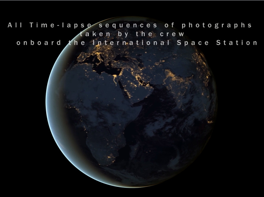
“All Time-lapse sequences were taken by the astronauts onboard the International Space Station (ISS) (Thanks guys for making this available to the public for use!) Hope you all enjoy it and thanks for watching!
https://64.media.tumblr.com/b7504b499ac2e7e1edd9d9aedfb36a73/b86aca1bf067899a-b6/s1280x1920/71badd6a5c023f3068b01dac8a1254688978cc2a.pnj
Music: “Manhatta” composed & performed by “The Cinematic Orchestra”
🌎
All rights reserved to their respective owners.
Edited by: Bruce W. Berry
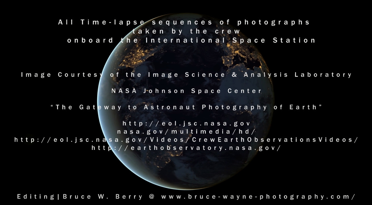
Image Courtesy of the Image Science & Analysis Laboratory,
NASA Johnson Space Center, The Gateway to Astronaut Photography of Earth”
eol.jsc.nasa.gov
eol.jsc.nasa.gov/Videos/CrewEarthObservationsVideos/
nasa.gov/multimedia/hd/
🌍
https://fstoppers.com/timelapse/timelapse-space-will-leave-you-humbled-3516
earthobservatory.nasa.gov/
🌏
Music: "Manhatta" composed & performed by “The Cinematic Orchestra”
All rights reserved to their respective owners.
Edited by: Bruce W. Berry
Image Courtesy of the Image Science & Analysis Laboratory,
NASA Johnson Space Center, The Gateway to Astronaut Photography of Earth"
eol.jsc.nasa.gov
eol.jsc.nasa.gov/Videos/CrewEarthObservationsVideos/
nasa.gov/multimedia/hd/
earthobservatory.nasa.gov/
Footage Note: The slower video represents a closer resemblance to the true speed of the International Space Station; this footage was shot at one frame per second. Clips are all marked with an *.
Locations of Footage in the order they appear:
1. A Jump over the Terminator
2. Sarychev Volcano
3. From Turkey to Iran*
4. Hurricane Irene Hits the US
5. Indian Ocean to Pacific Ocean Through the Cupola*
6. Central Great Plains at Night*
7. Aurora Borealis over the North Atlantic Ocean*
8. Aurora Borealis from Central U.S.*
9. Up the East Coast of North America*
10. Myanmar to Malaysia*
11. Western Europe to Central India
12. Middle East to the South Pacific Ocean
13. Aurora Borealis over Europe*
14. City Lights over Middle East*
15. European City Lights*
16. Northwest coast of United States to Central South America at Night
17. Moonglow over Canada and Northern U.S.*
18. Stars from the Pacific Ocean (1)
19. Stars from the Pacific Ocean (2)
20. Stars from the Pacific Ocean (3)
21. Stars and the Milky Way over the Atlantic*
22. The Milky Way and Storms over Africa (1)
23. The Milky Way and Storms over Africa (2)
Time-Lapse 🚀 Earth

"Astronauts have used hand-held cameras to photograph the Earth for more than 40 years, beginning with the Mercury missions in the early 1960’s. Crew members in space have taken nearly 750,000 photographs with Hasselblad, Linhof, Rolleiflex, and Nikon hand-held film cameras. Beginning in 1995, digital cameras were introduced on Shuttle missions. Today on the International Space Station all Crew Earth Observations (CEO) imagery is taken with a digital camera (see Munich International Airport, Germany for resolution information). The majority of these photographs are Earth-looking views. The remaining images show satellite deployments and activities outside the space craft (EVA’s--extra-vehicular activities).
Astronauts are trained in scientific observation of ecological, geological, geographic, oceanographic, environmental, and meteorological phenomena. They are also instructed in the use of photographic equipment and techniques. Preflight training helps the astronauts make informed decisions on which areas and phenomena to photograph. Specific areas of interest are selected by scientists before each six-month flight."

For the purposes of planning Earth observing photography or remote sensing, there are four important points about the orbits of the ISS. Particulars of the orbits depend on the exact altitude of the station, and the exact altitude depends on the frequency that the station is reboosted to a higher orbit.

FACT 1: The station travels from west to east on an orbital inclination of 51.6 degrees. Each orbit takes 90-93 minutes, depending on the exact altitude of the ISS. During that time, part of the Earth is viewed under darkness and part under daylight. The ISS orbital altitude drops gradually over time due to the Earth's gravitational pull and atmospheric drag. Periodic reboosts adjust the ISS orbit. As the ISS orbital altitude decays, the orbit tracks on Earth change slightly.

FACT 2: With each orbit taking 90-93 minutes, there are approximately 16 orbits per day (24 hours). The exact number of orbits per day is usually less than 16 (generally 15.5 to 15.9 orbits/day) depending on the altitude of the ISS. Each orbit shifts to the west by approximately 22.9° of longitude (measured as the position where the orbit crosses the equator).

FACT 3: There is an approximate repeat of orbit tracks over the same area on the ground every 3 days. Again, the ISS altitude will determine how closely the tracks repeat.

FACT 4: The part of the Earth visible to ISS astronauts in daylight changes due to the interaction between the orbit patterns of the station and the rotation of the Earth. The daylight portion of the orbits shifts slightly eastward along track each day. This lighting procession follows an approximate 63-day cycle from a descending track covering the mid-latitudes, to southern hemisphere lighting, to ascending tracks, to northern hemisphere lighting. This cycle, plus seasonal changes in solar incidence, cause the sun illumination angles to vary every time the station passes over a given region.

Cameras Used on the ISS and Shuttle Missions by NASA astronauts to photograph Earth
Hasselblad
Linhof
Hasselblad
Linhof
Maurer
Ansco Autoset
Nikon (film)
Rolleiflex
Skylab S190A
Skylab S190B
Sony HDW-700 High-definition Television Camera
Kodak DCS460 Electronic Still Camera
Nikon D1
Nikon D2Xs
Nikon D3
Nikon D3X
Nikon D3S
Canon Digital IXUS 700
Thanks again to Bruce Berry, The ISS Station, and Nasa.
*

🌎   🚀 🌍 🚀 🌏
#Peace On Earth Bird from Travel-Voyages