
How the U.S.
Took More Than 1.5 Billion Acres
From Native Americans
See Interactive Time-Lapse Map + VIDEO Below
By Rebecca Onion and Claudio Saunt
👇 👇
👇
Took More Than 1.5 Billion Acres
From Native Americans
See Interactive Time-Lapse Map + VIDEO Below
By Rebecca Onion and Claudio Saunt
👇
👇
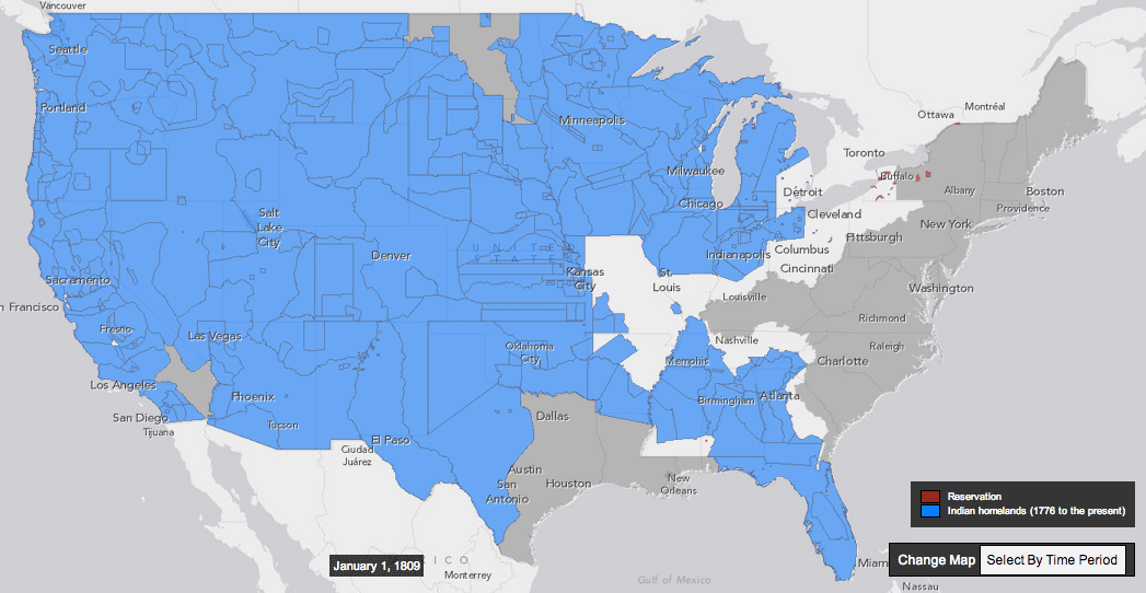
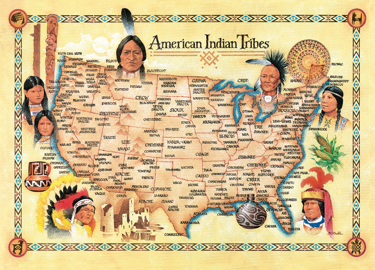
This interactive map, produced by University of Georgia historian Claudio Saunt to accompany his new book West of the Revolution: An Uncommon History of 1776,
offers a time-lapse vision of the transfer of Indian land between 1776
and 1887. As blue “Indian homelands” disappear, small red areas appear,
indicating the establishment of reservations. (Above is a GIF of the
map's time-lapse display; visit the map's page to play with its features.)
*
*
The project’s source data is a set of maps produced in 1899 by the Bureau of American Ethnology. The B.A.E. was a research unit of the Smithsonian
that published and collected anthropological, archaeological, and
linguistic research on the culture of North American Indians, as the
nineteenth century drew to a close.
*
*
While the time-lapse function is the most visually impressive aspect of this interactive, the “source map” option (available on the map's site)
offers a deep level of detail. By selecting a source map, and then
zooming in to the state you’ve selected, you can see details of the map
used to generate that section of the interactive. A pop-up box tells you
which Native nation was resident on the land, and the date of the
treaty or executive order that transferred the area to the government,
as well as offering external links to descriptions of the treaty and of
the tract of land.
*
In the site’s “About” section (reachable by clicking on the question
mark), Saunt is careful to point out that the westward-moving boundaries
could sometimes be vague. Asked for an example, he pointed me to the 1791 treaty with the Cherokee
that ceded the land where present-day Knoxville, Tenn. stands. The
treaty's language pointed to landmarks like "the mouth of Duck river," a
broad approach that left a lot of room for creative implementation.
When dealing with semi-nomadic tribes, Saunt added, negotiators
sometimes designated a small reservation, "rather than spelling out the boundaries of the cession."
*
This vagueness benefited the government’s purposes in crafting
treaties and executive orders. “Greater legality and more precision,”
Saunt argues, “would have made it impossible to seize so much land in so
short a time.”

The Invasion of America
Spotted Fins FishingThis doesn't show reservations that are southeast. Such as Eastern Band of Cherokee or Poarch Band of Creek. Which are both federally recognized
*
eHistory.org
The map only shows all Indian reservations over 640 acres.
eHistory.org
The map only shows all Indian reservations over 640 acres.
For a detailed view, please see our interactive site at invasionofamerica.ehistory.org.
*

The Invasion of America is a project of eHistory.org.
Project director: Claudio Saunt, Russell Professor of History at the University of Georgia
Technical director: Sergio Bernardes, Center for Geospatial Research
*

Invasion of America
How the United States Took Over an Eighth of the World
Between 1776 and 1887, the United States seized over 1.5 billion acres
from America's indigenous people by treaty and executive order.
The Invasion of America shows how by mapping every treaty and executive
order during that period. It also contains present-day federal Indian
reservations.
*
The data are based on the maps
produced by the Bureau of American Ethnology in 1899 under the guidance of Charles C. Royce.
The maps themselves are available under "Source Maps."
*
In treaty discussions, US troops often intimidated the negotiators,
federal agents misrepresented the terms of agreement, and land
speculators bribed participants. In desperate times, Indians signed
away their homes in order to feed themselves and their families.
In the 1850s, US presidents began using a second legal instrument to
secure land, the executive order, and this prerogative grew in
importance after 1871, when the federal government unilaterally stopped
making treaties with native peoples. The power of the president
to seize land by executive order may appear contrary to the sanctity of
private property, one of the great legacies of the American Revolution,
but white Americans never set Indian land title on the same footing as
their own. Nor did they recognize the irony of their presumptions.
*
In treaties and executive orders, the borders of each transaction are
often spelled out in general terms only, making it impossible to
map with any precision. That imprecision, which seems so foreign in
the era of Google maps, was integral to the process of seizing the
continent.
Government surveyors were sent out with the vaguest of descriptions.
They searched fruitlessly for headwaters, guessed which river fork they
were
supposed to ascend, and speculated where drainage basins began and
ended. Greater legality and more precision would have made it
impossible to
seize so much land in so short a time.
*
CREDITS
Project director: Claudio Saunt, Russell Professor of History at the University of Georgia
Technical director: Sergio Bernardes, Center for Geospatial Research
Special thanks to David Holcomb and Daniel Reeves at ITOS for implementing the map on ArcGIS Server.
*
* In the first scene, 1492, the first spanish colony wasn't in modern cuba, it was Hispañola.
Indigenous Peoples of the Americas
https://en.wikipedia.org/wiki/Indigenous_peoples_of_the_Americas
https://en.wikipedia.org/wiki/Indigenous_peoples_of_the_Americas
No comments:
Post a Comment