NASA Satellites
Show the Immense Scope of the Blizzard
About to Hit the East Coast
January 21, 2016
GOES Animation
of
January Blizzard 2016
VIDEO
VIDEO
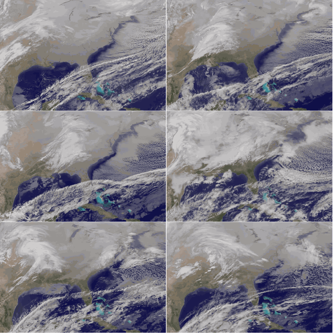
A 21 second animation of infrared and visible imagery from NOAA's
GOES-East satellite from Jan. 19 to 21 shows the movement one system
that moved across the southern U.S. on Jan. 20 followed by a second
storm system that is expected to bring the powerful winter storm to the
Mid-Atlantic. Credit: NASA/NOAA GOES Project
There's a blizzard coming! Are you aware? If you live in the
Northeast, you've likely heard some rumblings about it. Maybe because
forecasts have predicted that some areas will be buried in up to 18 or even 24 inches of snow this weekend. That's the height of a small child. Yikes.
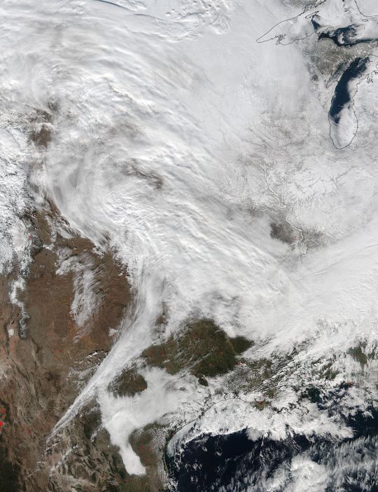
If you'd like to increase your anxiety levels even more so, NASA has you covered. The agency just released this awe-inducing picture,
captured from space, showing immense Winter Storm Jonas headed toward
the East Coast. The photo was taken with the Visible Infrared Imaging
Radiometer Suite (VIIRS) instrument on the Suomi NPP satellite — a probe
operated jointly by NASA and the National Oceanic and Atmospheric
Administration (NOAA). It shows the low pressure system over the south
central United States before it's expected to make its way east.
NASA
Supercomputer Model Shows
Supercomputer Model Shows
The Flow of Blizzard 2016.
VIDEO
VIDEO
If that still image isn't enough to freeze your appendages prematurely,
NASA also released a short animation of the storm's movements thus far,
made using visual and infrared data from NOAA's GOES-East satellite. So
if you're lucky enough to live on the East Coast, you can watch the
storm slowly creep toward you, preparing to make its precipitative
attack — all before you actually experience it on Saturday.


No comments:
Post a Comment